Remote sensing innovation toolkit
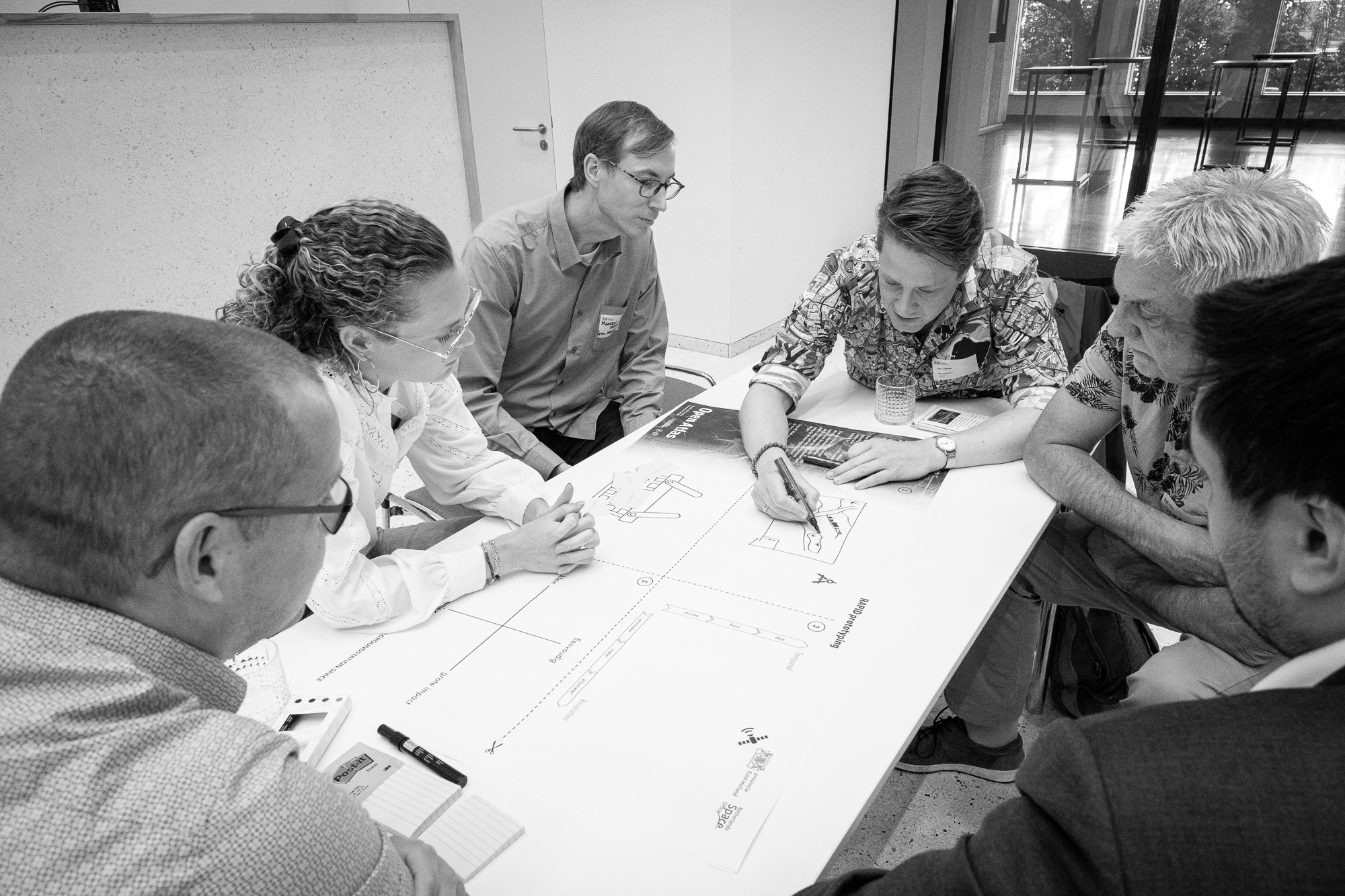
The Remote Sensing Innovation Toolkit provides a method for leveraging satellite data to create solutions in spatial planning, sustainability, and policymaking. It integrates exercises, technology guides, and case studies to assist users in tackling challenges and achieving results. Satellite data offers opportunities to comprehend trends and issues that are difficult to monitor. The toolkit aids policymakers, innovators, and technicians in identifying challenges, such as determining which spatial, social, or ecological issues can be addressed through remote sensing; designing solutions by aligning user needs, technical feasibility, and economic considerations; and learning from practical examples through successful application case studies.
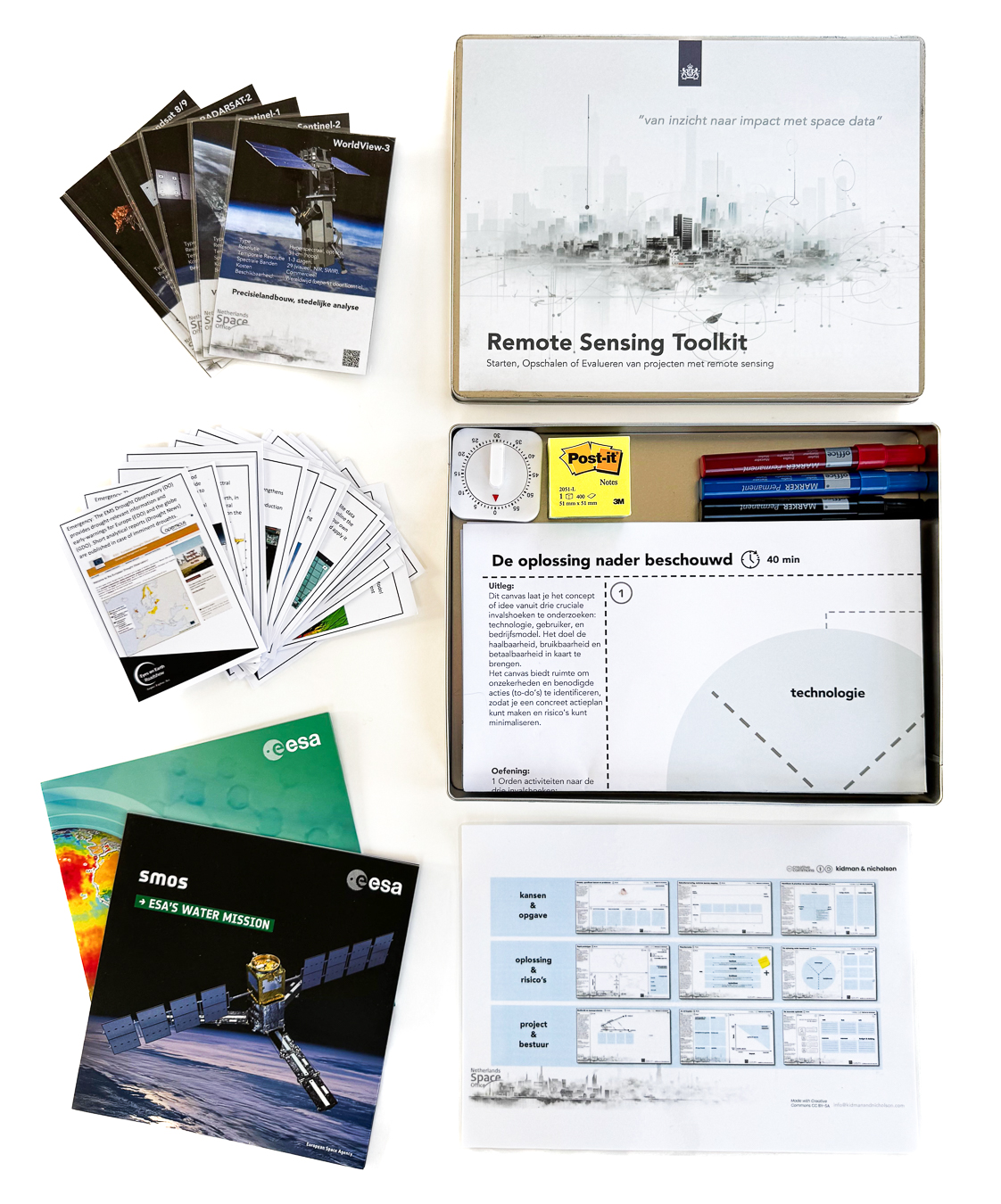
What’s Included in the Toolkit?
- Problem and Value Exploration Canvas; Identify the challenges and opportunities relevant to your organisation and ascertain how satellite data can help address them.
- Rapid Prototyping Framework: Create and test solutions through the “Sweet Spot of Innovation” exercise, where technology, user needs, and business cases converge.
- Prioritisation Exercises: Evaluate ideas using tools such as the Impact vs. Feasibility Matrix and the Effort vs. Effect Matrix.
- Satellite Data Technology Cards: Discover which satellites best meet your specific requirements, including details on resolution, spectral bands, and use cases.
- Inspiring Case Studies: Brief and impactful examples illustrating practical applications of remote sensing
- Innovation Assignment Template: Develop a practical implementation plan, including budget, timeline, and KPIs.
How Does It Work?
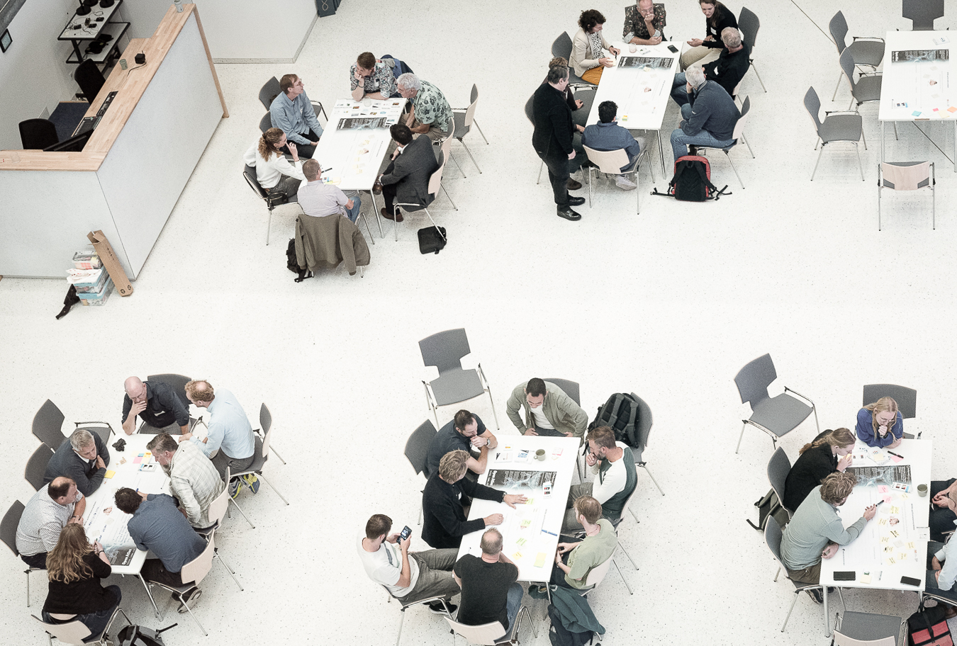
Whether utilised in an interactive workshop or independently, the toolkit guides users through four essential steps. It begins by identifying challenges using the Problem and Value Exploration Canvas, followed by designing solutions with tools such as Rapid Prototyping and prioritisation exercises. Users then select suitable datasets and technologies with the assistance of technology cards, culminating in the creation of a concrete action plan using the Innovation Assignment Template.
Discover How Satellite Data Can Empower Your Organisation
Interested in discovering how the Innovation Remote Sensing Toolkit can assist your organisation in developing innovative solutions? Learn from real-world examples and make use of tools that have already proven effective.
Contact us to schedule a workshop or organise a bespoke session.